

Category: california
-
Don Pedro reservoir near Yosemite NP California photo

Don Pedro Reservoir Part of system of lakes and reservoirs close to Yosemite NP, California, USA © 2010 Nick Katin. On the the Golden Chain highway that sort of runs from Sacramento south to Yosemite is an area of lakes and reservoirs. This particular patch of water is part of the very large Don Pedro reservoir that snakes close to the road so we were able to get a close look at it. As it was reasonably early in the morning I took a punt on leaving the polariser off so that I didn’t interfere too much with the reflections. 1/100 F16 85mm ISO100
Share this:
-
Another Half Dome Mountain in the famous Yosemite NP photo

Half Dome Mountain in the famous Yosemite NP photo © 2010 Nick Katin Based on the last Half Dome photo I posted it looks like this is a pretty popular national park. I enjoyed every minute of being there. I took this one from a lookout near Glacier Point Road after a bit of hike around there. I thought I’d start sharing some of the techniques I use. I took this at 1/60 at F16 and a focal length of 52 mm and didn’t use a tripod.
Share this:
-
View of eroded rock from Zabriskie Point Death Valley NP California photo
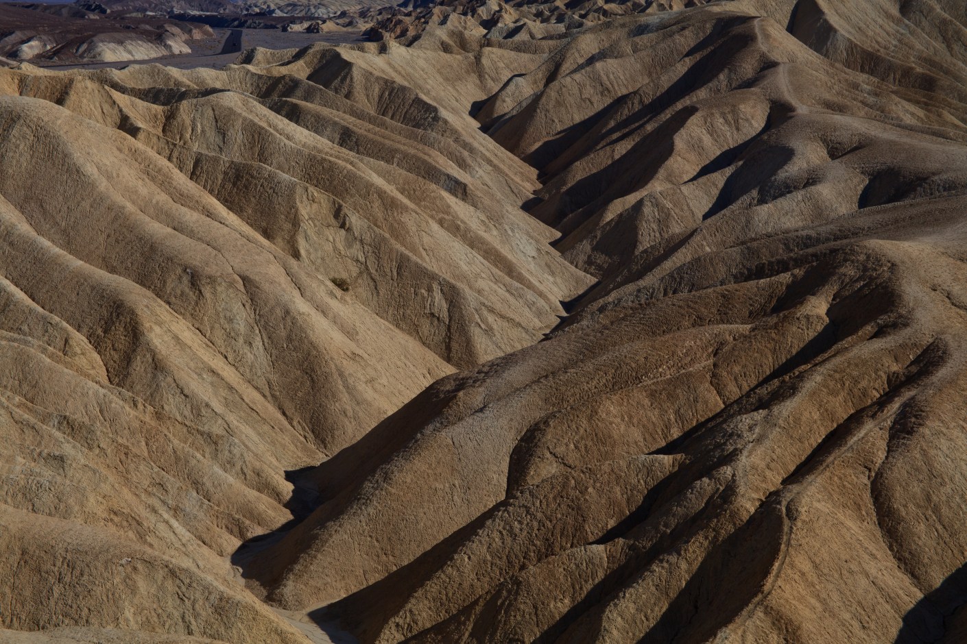
The infamous Zabriskie Point, more famously known as a movie is actually a lookout over an interesting landscape of yellow, brown and black rock formations called Badlands. Death valley itself straddles California and Nevada and as its name suggests is hot, dry, dusty and surprisingly the biggest national park in the lower 48 states of the US. But probably not somewhere you want to get lost especially in summer. I spent a bit of time just trying to capture the waving formations and the shadows they cast.Share this:
-
Half Dome Mountain in Yosemite National Park

Half Dome Mountain at Yosemite NP California, USA © 2010 Nick Katin You may have noticed that i have been posting twice a week for a while now, except for last week when I forgot! Things just got away from me and next thing you know I’ve missed it.
This is my take on the famous granite Half Dome mountain in Yosemite. It rises nearly 1500m from the valley floor and is probably the most photographed mountain in North America, certainly in Yosemite and for good reason. I took around 20 different angles of this monument and I’m not sure I came up with anything much different than has gone before.Share this:
-
Ellery lake Near Tioga pass, Yosemite National Park
The only road out from the eastern side of Yosemite is, Highway 120. It climbs up to a height of over 3000 metres through the Tioga pass. Lake Ellery was one of two lakes near the roadside just before reaching the highest point. It was early morning and the fresh clear air made for good picture making.
If you look close enough you can see see the reflection of snow topped mountains in the foreground – beautiful!
Ellery pass Near Tioga pass, Yosemite NP California, USA © 2010 Nick Katin Share this:


